
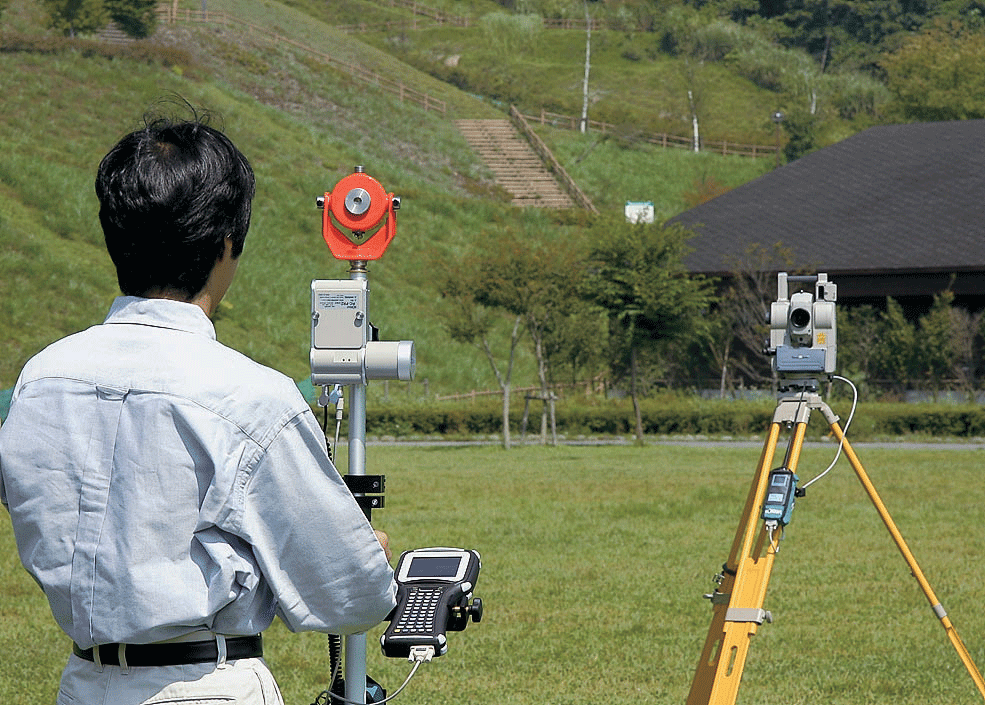
Field survey
Photogrammtry
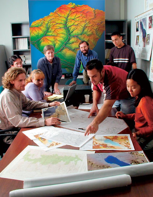
Geographic information systems
Fleet management system
Photogrammetry
The practice of determining the geometric properties of objects from photographic images by special cameras installed in the aircraft prepared for this purpose, This includes the coordinates and distances in order to know the location of the thing and what it is, and then represented in topographic maps or Non-topographic used in many engineering purposes
Photogrammetry has seen great development after the discovery of aircraft in the first century AD the past, and have developed the greatest during the two world wars in which, and all between the intensity of competition at the time, photography from the air that analysts can determine the images of enemy positions, and to monitor his movements, and know its mechanisms, including through effective , so control it easier and possible, and most of the digital imaging survey, even if the images are derived from the cameras and the hard nature, it turned to a scanner becomes digital images on the bench, such as those obtained directly from digital cameras
Photogrammetry has been defined by the American Society for Photogrammetry and Remote Sensing, art, science and technology to get reliable information about the material things and the environment through measurement and interpretation of photographs, and patterns of electromagnetic recorded radiant energy and other phenomena
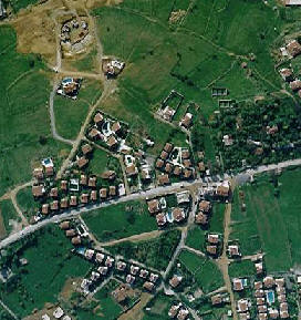
Photogrammetry is used in various fields, such as topographic mapping, architecture, engineering, manufacturing, quality control, and the police investigation, geology, as well as by archaeologists for the production of fast plans large sites or complex, and meteorology as a means to determine wind speed actual tornado.
Photogrammetry is classified in a manner other than through technical development, according to the distance between the camera and the photographer thing this types are:
Terrestrial Photogrammetry
Terrestrial photogrammetry is what the camera be installed on the ground to shoot certain landmarks, has less distance between the camera and the photographer to become a bit too short as it is in medical applications and this know as (Close Range Photogrammetry).
Has been possible to employ GPS technology with global imaging technology by installing the GPS on the plane in order to locate the camera in the air while imaging. And thus less dependence on the control points needed in the ground to link the pictures and then complete the required measurements.
Aerial Photogrammetry
Aerial Photogrammetry is what proves the camera on a plane in different height from the ground, according to the purpose of imaging, which determines its accuracy and cost needed.
Take pictures of the ground from a high place this term usually refers to images that do not support the floor structure of the camera. May be hand-held cameras and can capture images by the photographer, or cause the remote-controlled automatically. Platforms for aerial photography include fixed-wing aircraft, helicopters, balloons, balloons, rockets, kites, umbrellas and columns, and columns packed with vehicles. Should not be confused with aerial photography and aerial photography to aviation
Space Photogrammetry
Space Photogrammetry is proving what a camera on the satellite platforms, as is the case in remote sensing technology, in the field of space and identifies the planets and galaxies
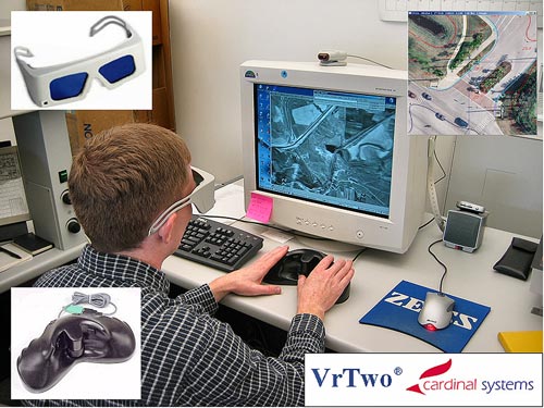
Digital Photogrammetry
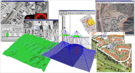
A branch is consider like terrestrial photogrammetry with the use of advanced methods of computer to collect, store and analyze data and information, and various image and in any digital system consists of two parts are software devices and hardware and in the digital Photogrammetry we need hardware and software with high-quality specifications must be characterized devices processes the powerful devices and high storage capacity
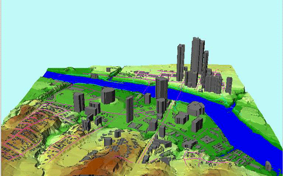
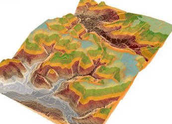
Produce digital images through the Federation and the complexity of systems of cells digital (pixel) and the language of punctuation unilateral of the computer typically used to create topographic maps, may also be useful in a variety of industries such as architecture, manufacturing, and the police investigation, and even plastic surgery, There are several important variables involved in digital photogrammetry: -
First, it may be useful for photogrammetrist to find out information about the camera, such as the type of camera to take a photograph, and the focal length of the lens, or at a distance from the camera to the object of interest. Is often used as a special type of camera, called a metric camera, to take these pictures because the calibration to capture accurate images with little distortion of the lens.
Second, to consider the digital photogrammetry for the dimensions of the required measurements. Some projects require only two-dimensional (2D) measurements, such as building height or width of the river. And these measurements can be made from a single image, but if you need measurements to three-dimensional (3D), the process usually involves then creates a 3D model of two or more photographs.
Equipment available with the company:
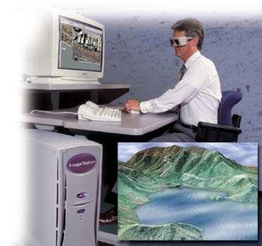
1- 5 stations mounted aerial survey by the following programs:
• Summit Evolution
• Data Capture for Micro Station – Auto Cad
• Contour Creator
2- 5 treatment plants Maps (Editing Workstation) programs mounted by the Map Editor
|
|
|
.jpg)
|
|
.jpg)
|
|
.gif)
|
.jpg)
|